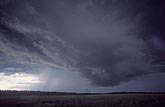
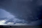
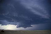
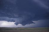
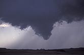
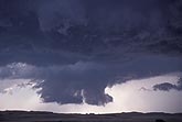
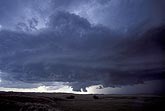
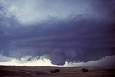
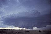
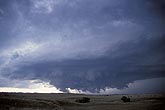
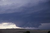
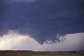
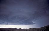
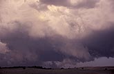
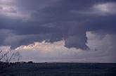
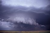
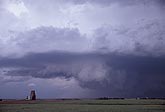
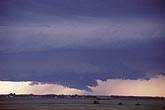
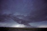
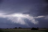
Wall clouds / lowerings: Stock photos of all wall clouds (mesocyclones) and cloud base lowerings associated with supercells and weaker storms. This is the inflow region (main updraft) feeding up into a severe storm cloud complex.

  • Severe storm with wall cloud lowering at focused inflow region
    • W002680Z
    • +
  • A collapsing wall cloud with a severe storm
    • W001427S
    • +
  • A wall cloud below the flanking line and inflow axis of a supercell
    • W001417Z
    • +
  • Close view of a typical wall cloud lowering on a supercell
    • W001411S
    • +
  • A tapered, funnel-shaped wall cloud extension
    • W001402Z
    • +
  • Close-up of partial wall cloud showing fragmented low clouds
    • W001391S
    • +
  • Elongating inflow axis on a supercell in an outflow-dominant phase
    • W001388Z
    • +
  • A prominent, rotating, backlit wall cloud
    • W001367S
    • +
  • Supercell showing wall cloud structure
    • W001355Z
    • +
  • Wet air condenses, forming rising scud
    • W001351Z
    • +
  • A supercell storm showing the mesocyclone structure
    • W001341S
    • +
  • Supercell storm with developing wall cloud updraft
    • W001335S
    • +
  • Circular updraft base under the mesocyclone of a supercell
    • W001307S
    • +
  • A tilted wall cloud on a passing gust front
    • W000540S
    • +
  • Close view of an incomplete cloud lowering under an updraft
    • W000528S
    • +
  • Close view of a well-formed wall cloud with a tail cloud
    • W993548Z
    • +
  • This dark flanking line axis of a severe storm has a circular wall cloud
    • W993538S
    • +
  • Cloud lowering under a storm base beneath a strong, new updraft
    • W993395S
    • +
  • wall cloud with a long inflow tail pointing back toward the rain
    • W991783S
    • +
  • Wall cloud and clear slot from rear flank downdraft (RFD)
    • W991511S
    • +