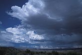
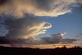
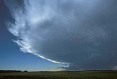
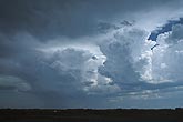
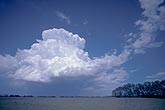
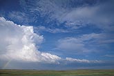
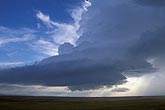
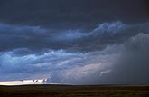
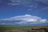
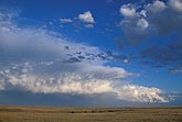
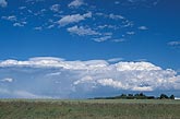
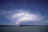
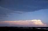
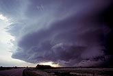
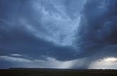
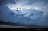
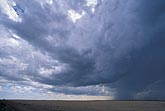
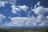
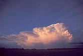
Overview: Stock photos with a wide view of the severe storm environment clouds showing the various parts and how they relate to each other.

  • Convection at all stages fills the view in this midday flush of activity
    • W033732Z
    • +
  • A shaded storm sends out fingers of frozen anvil cloud
    • W032644Z
    • +
  • Approaching storm cloud features: flanking line and mamma
    • W031254Z
    • +
  • A storm is sending clues about its severity in its sharp anvil
    • W031238S
    • +
  • A dominant storm controls nearby clouds, flattening weaker Cumulus
    • W031198Z
    • +
  • A multicell storm type has formed a thunderhead with a hard anvil
    • W031087S
    • +
  • A storm cloud with structure which is simple but efficient
    • W023115Z
    • +
  • The lifted condensation level and the level of free convection
    • W023075Z
    • +
  • Higher, flat clouds in the cool air behind a passing thunderstorm
    • W022858Z
    • +
  • This circular Cumulonimbus shows the vertical structure of a storm
    • W022600Z
    • +
  • A squall line is weakening as buoyancy decreases in the evening air
    • W022417Z
    • +
  • Storm crowns with Velum, a Cumulonimbus accessory cloud type
    • W022375S
    • +
  • Unusual cloud formed by slow convection in marginal instability
    • W022083Z
    • +
  • Thunderstorm cloud survival and persistence: storm environment
    • W021788S
    • +
  • A large area of updrafts fills the inflow side of a severe storm
    • W021586S
    • +
  • Gathering storm clouds blasting toward a new storm cell
    • W020966Z
    • +
  • A cold front coming in as a long cloud bank
    • W020499Z
    • +
  • Cloud lines and winds around storms: inflow and outflow
    • W020345S
    • +
  • Daily summer routine of strong up and down convection air currents
    • W013737Z
    • +
  • Multicell thunderstorm cloud structure: anvil flange detail
    • W013439Z
    • +