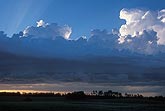
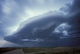
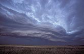
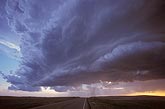
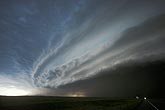
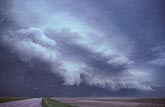
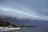
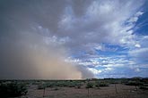
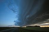
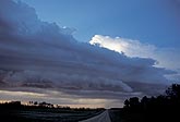
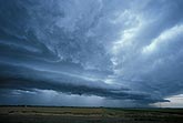
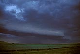
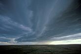
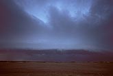
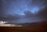
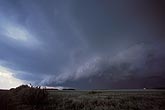
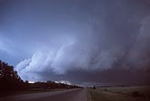
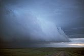
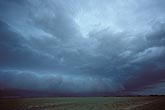
Gust fronts - before: Stock photos of gust fronts (shelf clouds or Arcus accessory clouds) as they appear on the forward edge, ahead of the cooler air and precipitation with a severe storm cloud complex.

  • Gust front axis with flanking line and leading (wind shift) cloud line
    • W031302Z
    • +
  • The shelf cloud races ahead in the outflow stage surge of a thunderstorm
    • W012945Z
    • +
  • A multi-layered shelf cloud (Arcus) with a loose wave-like pattern
    • W012907Z
    • +
  • A shelf cloud or Arcus accompanies the gust front of a high-based storm
    • W000678Z
    • +
  • Multi-tiered Arcus cloud on an intense hail storm
    • W930547S
    • +
  • A storm gust front in transition to high-precipitation (HP) supercell
    • W930510Z
    • +
  • Distant thunder and a fast moving Arcus (gust front) bear down on lake
    • W915512S
    • +
  • A desert haboob or dust storm accompanies an outflow boundary
    • W032246Z
    • +
  • A gust front brings a sudden change in the weather
    • W031318S
    • +
  • A gust front with an outflow boundary is moving in
    • W031313S
    • +
  • Wind shift boundary with bubbling cloud line in the lift zone
    • W031301Z
    • +
  • A weak high based shelf cloud along an outflow boundary
    • W030238Z
    • +
  • A shelf cloud stands out as a light line in the midst of black clouds
    • W022757Z
    • +
  • An unusual shelf cloud along a gust front, with several layers
    • W022728Z
    • +
  • Shading and structure of thunderstorm shelf cloud layers
    • W021826Z
    • +
  • Storm gust front cloud progression: sharp-edged Arcus
    • W021821Z
    • +
  • A light line of low cloud, warning that a storm is on the way
    • W021782Z
    • +
  • Close view of low cloud flakes and ruffles on a gust front
    • W021770Z
    • +
  • A close look at a gust front cloud shaped like a wedge
    • W021019Z
    • +
  • Clouds are thickening and lowering as a strong squall line approaches
    • W021011Z
    • +